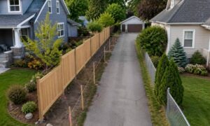
Many homeowners start a project with a simple plan. Maybe they want a new fence for privacy. Others want to build a garage, add a small deck, or improve the backyard. At first, the project feels easy. However, once planning begins, many people hear about something they did not expect — land survey cost.
This often surprises homeowners. After all, the project may seem small. Some people think a survey only means finding the property corners. Yet the work behind a survey involves much more than that. Many homeowners start searching online to understand the typical land survey cost for homeowners, only to realize that the process involves research, field measurements, and legal responsibility. Once people understand what goes into the work, the price begins to make more sense.
Many Homeowners Think a Survey Is Quick
Most people picture a survey as someone walking around the yard with a tool and placing a few flags. Because of this idea, they expect the work to be quick and inexpensive. However, as homeowners begin to understand what affects land survey cost, they often realize that a professional survey involves much more work behind the scenes.
Before surveyors even step onto the property, they often spend time studying records. They review old property deeds, subdivision maps, and previous surveys. They also check easements and right-of-way information. These records help them confirm the legal boundary of the land.
After that research, the survey crew visits the site. They measure the land carefully using advanced equipment. Then they analyze the data to confirm the property lines.
Because of these steps, land survey cost includes both research and field work.
Online Maps Make Boundaries Look Simple
Today, many homeowners check their property lines online. Several websites show parcel maps and satellite images. At first glance, these maps look accurate.
However, these maps only show approximate boundaries.
They help people see general property locations, but they do not show legal boundary lines. The lines may appear clear on a screen, yet they may sit several feet away from the true property corner.
Because of this difference, contractors and city offices often require a licensed survey before construction begins.
As a result, homeowners who rely on online maps may feel surprised when they learn about the land survey cost needed for real measurements.
Property Projects Often Trigger the Need for a Survey
Many projects around the home can require a survey. Even small changes to a property can raise boundary questions.
For example, homeowners often request surveys when they plan to:
- Install a new fence
- Build a detached garage
- Add an extension to the house
- Replace a driveway near a property line
- Improve a yard close to a neighbor’s property
These projects may look simple. However, building near a property line always carries risk. Even a mistake of one or two feet can cause problems later.
Therefore, a survey helps confirm that the work stays within the correct boundary.
Older Neighborhoods Add More Survey Work
Minneapolis includes many historic neighborhoods. While these areas have charm and character, they can also create challenges for surveyors.
Older subdivisions often contain records that go back many decades. In some cases, the original markers placed in the ground may have moved or disappeared.
For example, property corners can become buried under soil, pavement, or landscaping. Sometimes construction from nearby homes hides the markers completely.
When this happens, surveyors must locate other evidence to rebuild the property line. They measure nearby corners and compare old records. Then they calculate the correct position of the boundary.
Because this process takes time and expertise, it can affect the overall land survey cost.
Field Equipment Must Be Precise

Surveyors rely on highly accurate tools when they measure land.
Modern survey crews use advanced equipment that can measure distances and angles with great precision. These tools allow surveyors to confirm property lines within small margins of error.
While the equipment helps produce reliable results, it also requires training and careful setup. Surveyors must gather data from several points across the property. They also record every measurement for later analysis.
This detailed process protects the accuracy of the survey.
Surveys Carry Legal Responsibility
Another reason behind land survey cost involves professional responsibility.
A survey does not only guide construction. It also becomes a legal document. Property owners, builders, and even lenders may rely on it.
Because of this responsibility, licensed surveyors must confirm that every boundary matches legal records and physical evidence. If mistakes occur, they could create disputes between neighbors or problems during property sales.
Therefore, surveyors take great care during both research and field work. Their training and licensing help ensure the final survey provides reliable information.
Surveys Help Prevent Costly Problems
Although some homeowners hesitate when they hear the price of a survey, the service often prevents larger issues.
For instance, imagine installing a fence only to learn later that it crosses onto a neighbor’s property. Fixing that mistake could require moving the fence or even removing sections of it.
Similarly, building a garage too close to the boundary may violate setback rules. In that case, the structure might require costly changes or delays.
However, a survey helps avoid these problems from the start.
By confirming the exact boundary location, the survey protects both the homeowner and nearby properties.
Planning Ahead Helps Reduce Surprises
Fortunately, homeowners can take simple steps to prepare for land survey cost.
First, they should ask whether a recent survey already exists for the property. Sometimes previous owners ordered one during a home purchase.
Next, homeowners can discuss their project plans with the surveyor early in the process. When surveyors understand the project, they can focus their work on the most important areas.
Finally, gathering old documents such as deeds or previous surveys can help speed up the research stage.
These steps can make the survey process smoother and more efficient.
A Survey Is the First Step Toward a Successful Project
While land survey cost may surprise some homeowners at first, the service provides valuable protection. Surveys confirm property boundaries, support construction planning, and help prevent disputes between neighbors.
More importantly, they give homeowners confidence that their project starts on solid ground.
Whether someone plans to install a fence, build a garage, or improve the backyard, a professional survey helps ensure the work stays within the correct property lines. With that knowledge in place, homeowners can move forward with their improvements and enjoy their property with peace of mind.