For decades, the role of a licensed land surveyor in the Twin Cities has been grounded—literally—in the field. Tripods, total stations, and long days marking boundaries were the norm. But lately, surveyors across Minneapolis and St. Paul are noticing a shift. With more builders using layout crews and drone data, traditional fieldwork is tightening. At the same time, office-based work—like CAD drafting, data processing, and quality control—is growing fast.
If you’ve been following industry threads online, especially on Reddit, you’ve probably seen the same frustration: “I need office time, but every firm wants experience first.” Or “Our topo work is shrinking while drones and layout guys take over.” These aren’t just rants. They’re real concerns that show how the profession is changing.
Still, this shift isn’t the end of traditional surveying—it’s an opportunity. Surveyors who learn to bridge the gap between field and office will be the ones leading projects, not just staking them.
The Changing Landscape in Minneapolis–St. Paul
Here in the Twin Cities, construction never really stops. Winter might slow down new site work, but underground utility, commercial, and infill projects continue. Local developers are pushing vertical construction, tighter plats, and mixed-use designs. That means precision and documentation are more important than ever.
Yet, many firms are cutting back on traditional field topo surveys. Drones now capture large areas in minutes, and builders often rely on layout contractors for quick stakings. The result? Fewer hours for field surveyors—and more need for those who can handle digital deliverables in the office.
It’s not just about efficiency. Local governments are raising expectations too. The City of Minneapolis and Hennepin County now emphasize accurate GIS data and seamless digital submittals. So, surveyors who understand both field data collection and office drafting are becoming the go-to experts.
Why the Reddit Complaints Matter
Surveyors are talking because they care. Those online frustrations reflect a bigger truth: the profession is being reshaped by technology, workflow pressure, and generational change.
Many field surveyors want to move into office roles but hit a wall. Employers say, “We need someone with CAD experience.” But how do you gain that experience if you never get the chance? Others worry that drones, GPS, and AI will replace their fieldwork altogether.
In reality, those who adapt—who combine field know-how with office accuracy—will remain essential. Machines may collect data, but licensed surveyors still ensure that data meets legal standards and aligns with real-world boundaries.
Bridging the Gap: A Field-to-Office Mindset
Transitioning from field to office isn’t about abandoning what you know. It’s about translating it. When you understand how every stake, shot, and benchmark connects to a CAD line, your value multiplies.
Start by learning the office language: Civil 3D, coordinate systems, and local drafting standards. In Minneapolis, most firms follow county datums and standardized layer naming. When your field notes already match those formats, you make your data easier to process—and you stand out.
Next, shadow your office team when possible. Watch how your raw data becomes surfaces, contours, and boundary maps. You’ll notice patterns: small field details that save hours of cleanup in the office. That’s how you move from data collector to data manager.
The Rise of Technology (and Why It’s Not a Threat)

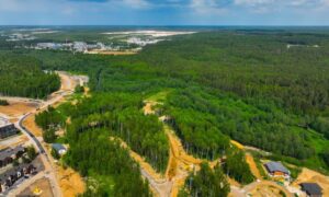
Let’s talk about the elephant—or rather, the drone—in the room. Aerial and UAV surveys are changing how work gets done. Drones can map a 50-acre site in an afternoon, but they still need control points and verification. That’s where licensed land surveyors come in.
In the Twin Cities, there are unique flight restrictions near the MSP Airport and along the Mississippi River corridor. So, it takes professional oversight to ensure data meets FAA and Minnesota Board of Architecture, Engineering, Land Surveying, and Geoscience standards.
Instead of viewing drones as competition, think of them as tools that expand your reach. While a pilot collects imagery, you can focus on analysis, adjustments, and client coordination. You’re not being replaced—you’re being upgraded.
Diversifying Your Scope (Especially During Slow Seasons)
Survey firms have found smart ways to stay productive year-round. During winter months, when snow makes topo work tough, they pivot.
Some focus on ALTA/NSPS surveys for commercial properties. Others prepare elevation certificates for insurance or FEMA LOMA submissions. There’s also steady demand for utility as-built surveys and construction staking surveys inside heated facilities or underground sites.
These services keep the team working while strengthening relationships with developers and homeowners. And they show clients that licensed surveyors don’t just “measure land”—they safeguard projects through every stage of development.
What Clients Should Know
Property owners and builders might not follow every industry debate online, but they feel the impact when survey teams are understaffed or stretched thin. That’s why it’s worth hiring firms that invest in both field and office training.
A licensed land surveyor who understands how to process, check, and interpret data can deliver results faster and more accurately. They anticipate issues before they appear on site. For a client, that means fewer delays, fewer redesigns, and smoother closings.
When evaluating survey proposals, don’t just compare prices. Ask: “Who reviews the data before the final plat?” and “How experienced is your team with digital submittals for my city or county?” A good firm will gladly explain their workflow—and that’s a good sign you’re in capable hands.
Building a Future-Ready Profession
The transition from field to office isn’t just a personal career move; it’s the evolution of the profession itself. Licensed land surveyors in the Twin Cities are already redefining what expertise looks like. They’re combining hands-on precision with digital fluency. They’re turning raw points into reliable decisions.
That blend of skills will shape the next generation of projects—from downtown high-rises to suburban redevelopment. And as cities like Minneapolis continue to densify, the need for people who can balance physical accuracy with data accuracy will only grow.
So, if you’re feeling the pressure of this changing landscape, remember this: surveying has always been about adaptation. From chains to GPS, from manual drafting to drones, every new tool has challenged surveyors to level up. This moment is no different.
The best way forward? Keep learning, keep collaborating, and keep connecting the dots—both in the field and behind the screen.
Because in the Twin Cities, the future of surveying belongs to those who can stand on solid ground and still see the bigger picture.For decades, the role of a licensed land surveyor in the Twin Cities has been grounded—literally—in the field. Tripods, total stations, and long days marking boundaries were the norm. But lately, surveyors across Minneapolis and St. Paul are noticing a shift. With more builders using layout crews and drone data, traditional fieldwork is tightening. At the same time, office-based work—like CAD drafting, data processing, and quality control—is growing fast.
If you’ve been following industry threads online, especially on Reddit, you’ve probably seen the same frustration: “I need office time, but every firm wants experience first.” Or “Our topo work is shrinking while drones and layout guys take over.” These aren’t just rants. They’re real concerns that show how the profession is changing.
Still, this shift isn’t the end of traditional surveying—it’s an opportunity. Surveyors who learn to bridge the gap between field and office will be the ones leading projects, not just staking them.
The Changing Landscape in Minneapolis–St. Paul
Here in the Twin Cities, construction never really stops. Winter might slow down new site work, but underground utility, commercial, and infill projects continue. Local developers are pushing vertical construction, tighter plats, and mixed-use designs. That means precision and documentation are more important than ever.
Yet, many firms are cutting back on traditional field topo surveys. Drones now capture large areas in minutes, and builders often rely on layout contractors for quick stakings. The result? Fewer hours for field surveyors—and more need for those who can handle digital deliverables in the office.
It’s not just about efficiency. Local governments are raising expectations too. The City of Minneapolis and Hennepin County now emphasize accurate GIS data and seamless digital submittals. So, surveyors who understand both field data collection and office drafting are becoming the go-to experts.
Why the Reddit Complaints Matter
Surveyors are talking because they care. Those online frustrations reflect a bigger truth: the profession is being reshaped by technology, workflow pressure, and generational change.
Many field surveyors want to move into office roles but hit a wall. Employers say, “We need someone with CAD experience.” But how do you gain that experience if you never get the chance? Others worry that drones, GPS, and AI will replace their fieldwork altogether.
In reality, those who adapt—who combine field know-how with office accuracy—will remain essential. Machines may collect data, but licensed surveyors still ensure that data meets legal standards and aligns with real-world boundaries.
Bridging the Gap: A Field-to-Office Mindset
Transitioning from field to office isn’t about abandoning what you know. It’s about translating it. When you understand how every stake, shot, and benchmark connects to a CAD line, your value multiplies.
Start by learning the office language: Civil 3D, coordinate systems, and local drafting standards. In Minneapolis, most firms follow county datums and standardized layer naming. When your field notes already match those formats, you make your data easier to process—and you stand out.
Next, shadow your office team when possible. Watch how your raw data becomes surfaces, contours, and boundary maps. You’ll notice patterns: small field details that save hours of cleanup in the office. That’s how you move from data collector to data manager.
The Rise of Technology (and Why It’s Not a Threat)
Let’s talk about the elephant—or rather, the drone—in the room. Aerial and UAV surveys are changing how work gets done. Drones can map a 50-acre site in an afternoon, but they still need control points and verification. That’s where licensed land surveyors come in.
In the Twin Cities, there are unique flight restrictions near the MSP Airport and along the Mississippi River corridor. So, it takes professional oversight to ensure data meets FAA and Minnesota Board of Architecture, Engineering, Land Surveying, and Geoscience standards.
Instead of viewing drones as competition, think of them as tools that expand your reach. While a pilot collects imagery, you can focus on analysis, adjustments, and client coordination. You’re not being replaced—you’re being upgraded.
Diversifying Your Scope (Especially During Slow Seasons)
Survey firms have found smart ways to stay productive year-round. During winter months, when snow makes topo work tough, they pivot.
Some focus on ALTA/NSPS surveys for commercial properties. Others prepare elevation certificates for insurance or FEMA LOMA submissions. There’s also steady demand for utility as-built surveys and construction staking surveys inside heated facilities or underground sites.
These services keep the team working while strengthening relationships with developers and homeowners. And they show clients that licensed surveyors don’t just “measure land”—they safeguard projects through every stage of development.
What Clients Should Know
Property owners and builders might not follow every industry debate online, but they feel the impact when survey teams are understaffed or stretched thin. That’s why it’s worth hiring firms that invest in both field and office training.
A licensed land surveyor who understands how to process, check, and interpret data can deliver results faster and more accurately. They anticipate issues before they appear on site. For a client, that means fewer delays, fewer redesigns, and smoother closings.
When evaluating survey proposals, don’t just compare prices. Ask: “Who reviews the data before the final plat?” and “How experienced is your team with digital submittals for my city or county?” A good firm will gladly explain their workflow—and that’s a good sign you’re in capable hands.
Building a Future-Ready Profession
The transition from field to office isn’t just a personal career move; it’s the evolution of the profession itself. Licensed land surveyors in the Twin Cities are already redefining what expertise looks like. They’re combining hands-on precision with digital fluency. They’re turning raw points into reliable decisions.
That blend of skills will shape the next generation of projects—from downtown high-rises to suburban redevelopment. And as cities like Minneapolis continue to densify, the need for people who can balance physical accuracy with data accuracy will only grow.
So, if you’re feeling the pressure of this changing landscape, remember this: surveying has always been about adaptation. From chains to GPS, from manual drafting to drones, every new tool has challenged surveyors to level up. This moment is no different.
The best way forward? Keep learning, keep collaborating, and keep connecting the dots—both in the field and behind the screen.
Because in the Twin Cities, the future of surveying belongs to those who can stand on solid ground and still see the bigger picture.
