If you’ve heard about Graco moving out of their big property along the Mississippi River in Minneapolis, you know this opens up a huge chance for new development. The site covers 40 acres of prime riverfront land. But before anything new can be built, surveyors need to take a close look at the land. This is where drone surveying is changing the game.
Drone surveying uses small flying machines, called drones, to fly over land and take pictures and measurements. These drones have special cameras and sensors that collect data faster and more safely than traditional methods. Especially for a large, tricky site like the Minneapolis riverfront, drone surveying makes a big difference.
What Makes the Graco Riverfront Site a Challenge?
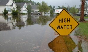
This 40-acre site isn’t simple. It sits right next to Graco Park and near some neighborhoods. Surveyors need to be very careful because there are wetlands, uneven ground, and places that flood when the river rises. Also, city rules about zoning and land use mean surveyors must gather detailed information.
Normally, surveyors would walk the site, measure points, and check elevations by hand. This takes a long time—sometimes weeks—and can cost a lot. But waiting too long means the project could be delayed.
Why Traditional Surveying Can Be Tough Here
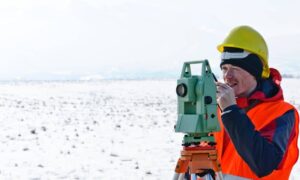
Traditional land surveying means walking around with equipment to measure distances and elevations. Surveyors use tools like GPS receivers and total stations to mark points. This works well on smaller or easy-to-reach land.
But this riverfront site has problems:
- Some parts near the river are hard or unsafe to reach.
- Trees and thick plants block the view, making it hard to get good measurements.
- Surveyors risk slipping or accidents near flood zones.
These challenges make the work slow and sometimes less accurate.
How Drone Surveying Changes Everything
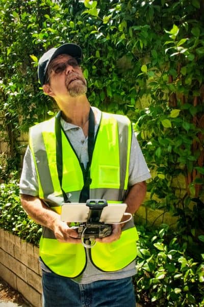
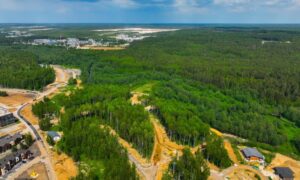
Drones are like flying robots with cameras and sensors that zoom over the land. They take thousands of pictures and measurements quickly. Within hours, surveyors have a complete, detailed map of the whole 40-acre site.
Why is this better?
Access: Drones get into spots where people can’t easily go, like steep riverbanks or thick forests.
Speed: Drones can scan large areas much faster than people on foot. What could take days can now take just a few hours.
Safety: Drones fly over risky or hard-to-reach places. This keeps surveyors safe on the ground.
Accuracy: The high-tech sensors give very precise data, including how high or low the land is. This is very important for flood-prone areas.
How Drone Surveying Supports Different Types of Surveys
Big projects like this need many kinds of surveys to move forward:
- Boundary Line Surveys: These show exactly where the property lines are. Drones help confirm these from the air.
- Due Diligence Surveys: Before buying or developing land, buyers want to know everything about the site. Drone data shows the shape of the land, wetlands, and any problems.
- Construction Staking Surveys: When building starts, crews need exact spots marked where to dig or build. Drone maps make this faster and more precise.
- Elevation Certificates: Since the land is near the river, officials require proof of land height to understand flood risks. Drones collect this information in detail.
What Local Surveyors Say About Drone Surveying
Licensed land surveyors in Minneapolis are already using drones a lot, especially for big projects like the Graco redevelopment. They say drones save time, lower costs, and help avoid mistakes.
One surveyor said, “Using drones helps us spot details we might miss walking on the ground. It also speeds up the whole process so construction can start sooner.” For developers and property owners, that means fewer headaches and faster approvals for loans and permits.
Why Drone Surveying Matters to You
If you’re a developer, investor, or property owner, drone surveying can make your project easier and safer. Here’s why you should care:
- Better Data, Less Risk: Drones give accurate maps so you avoid costly mistakes about property lines or site conditions.
- Faster Loan Closings: Banks and lenders need precise surveys before giving money. Drones help speed up these surveys, so financing isn’t held up.
- Save Money: Less time spent on surveys means lower costs for your whole project.
- Modern Technology: Drone surveying is becoming the new standard. Using it means you’re working with the best tools available.
How to Choose the Right Drone Surveyor in Minneapolis
Not every land surveyor uses drones yet. When picking one, look for:
- Licensing: Make sure they are licensed.
- Drone Experience: Ask if they’ve done projects with drone surveying, especially big urban ones.
- Fast Turnaround: Find out how quickly they can give you the survey results.
- Clear Communication: They should explain what the data means in simple words.
A good surveyor will walk you through the whole process and answer your questions.
What Happens Next with the Riverfront Redevelopment?
With Graco’s move, this land is ready for new ideas and new buildings. Surveying is the first step to making that happen. Drone surveying gives the city planners, developers, and property owners clear, accurate data so they can plan right.
It also helps get the loans and permits needed without delays. That means construction can start sooner, and the riverfront can become a vibrant part of Minneapolis again.
The Future Is Flying High
Graco’s 40-acre riverfront site is a rare chance for big change. Surveying this land is a big job, but drone surveying makes it easier, safer, and faster. By using drones, surveyors deliver better data to help developers build smarter and city officials plan better.
If you’re involved in land development or real estate, now is the time to learn about drone surveying. It’s not just cool technology—it’s a practical tool that saves money, cuts delays, and helps everyone make better decisions.
