LiDAR mapping may sound technical, but it’s actually a helpful tool that more and more property owners are using to make smarter decisions. Whether you’re planning a home addition, buying land, or working on a commercial project, LiDAR can give you the detailed information you need to move forward with confidence.
Let’s break it down in a way that’s easy to understand, and show how this powerful technology could benefit your next project.
What is LiDAR Mapping, Really?
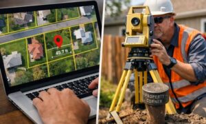
LiDAR stands for Light Detection and Ranging. Think of it like radar—but instead of sound, it uses laser light to measure the shape of the ground and everything on it. Special equipment sends out thousands of laser pulses per second, and when they bounce back, it records how far away things are. When all those measurements are combined, they create a super-detailed 3D map of your property.
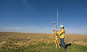
This mapping can be done by drones flying overhead or by scanners set up on tripods. It works well even in areas with trees or uneven ground, which is great for many parts of Minneapolis.
Why Should Property Owners in Minneapolis Care?
If you own land in Minneapolis, you probably know how important it is to understand the layout of your property—especially if you’re planning to build, landscape, or develop.
LiDAR helps you see:
- Where your land rises or dips
- How water flows across your property
- What trees, structures, or obstacles are in the way
For older neighborhoods or lots with tricky terrain, having this data means fewer surprises—and fewer headaches—down the road.
Real Benefits You Can Actually Use
LiDAR isn’t just fancy tech—it solves real problems and makes your project easier.
1. Accurate Measurements
You’ll get clear and precise details about slopes, low spots, and elevation changes—more accurate than old-school methods.
2. Saves Time
LiDAR mapping is fast. What used to take days can now be done in a few hours. That means less waiting and more doing.
3. Smart Investment
Before spending thousands on construction, wouldn’t it be smart to know if your land is ready? LiDAR shows potential issues early, so you can plan better and avoid extra costs later.
Where LiDAR Makes a Difference
Drainage and Flooding
Minneapolis weather can be unpredictable. One heavy rainstorm can show you why drainage matters. LiDAR helps plan for water flow, so you’re not stuck with flooding or erosion issues.
Designing Outdoor Spaces
Whether you’re adding a patio, a new garage, or doing some serious landscaping, knowing how your land is shaped helps make design smoother and more efficient.
Commercial Projects
For larger developments, like apartment complexes or office buildings, LiDAR gives planners and engineers the reliable data they need to stay on track and under budget.
Not Just for Big Jobs: Small Lots Benefit Too
Even if you just own a small city lot, you’ll be surprised at how helpful LiDAR can be. It can:
- Show where to place a shed or garden
- Help you level the yard for a deck or patio
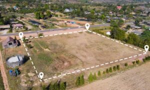
- Confirm boundaries before putting up a fence
It’s a powerful tool that works for almost any size property.
How It Works With Other Survey Types
LiDAR is often used along with:
- Boundary Surveys – to legally define your property lines
- ALTA/NSPS Surveys – for commercial deals and lender requirements
- Construction Staking – to guide building crews on where to dig or build
While LiDAR doesn’t replace legal boundary surveys, it adds detail that helps everyone—from homeowners to contractors—understand the land better.
Choosing the Right Survey Team in Minneapolis
Not all surveyors offer LiDAR mapping. When you’re looking for help, ask:
- Do they use drone or tripod LiDAR?
- Are they licensed in Minnesota?
- How quickly can they complete the job?
- Can they explain the results in simple terms?
Experience matters—especially in a city like Minneapolis with hills, lakes, and mixed terrain.
Common Questions from Minneapolis Property Owners
How accurate is it?
LiDAR systems today can measure within a few centimeters, which is perfect for most residential and commercial needs.
Can it be done in the winter?
Yes, but deep snow can cover ground features. We recommend spring, summer, or fall for the clearest results.
How much does it cost?
Prices vary depending on the size and complexity of the property, but we offer free consultations to help you decide what’s best.
Do I need a legal survey too?
In most cases, yes—especially if you’re buying, selling, or building. LiDAR adds detail but doesn’t replace legal boundaries.
How do I get started?
Reach out to a licensed land surveyor in your area who offers LiDAR services. Share your project goals, and they can guide you through the next steps—from evaluating your site to delivering a detailed map.
In Summary
LiDAR mapping in Minneapolis MN is a smart way to get a full picture of your land—literally. It gives you the details you need to plan smarter, build better, and avoid surprises. Whether you’re a homeowner planning a backyard project or a developer working on a commercial site, this technology can make a real difference.
